
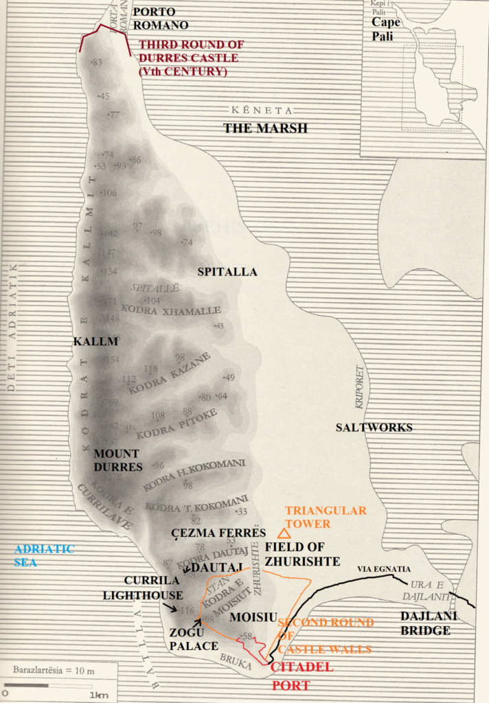
The hills of Durres: Near an erosion danger
Introuction
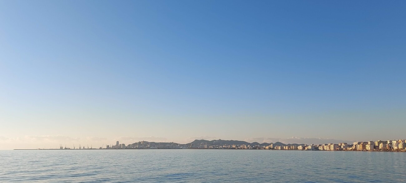
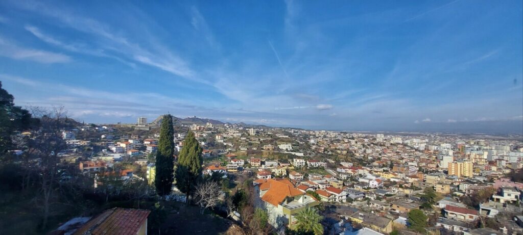
With a 3000 year history, Durres is well renowned for its lush hills made of clay. They stretch all the way to Porto Romano from the Durres port’s entrance. They are typical views from Durres’ beach and the surrounding areas because they give visitors the feeling that Durres was once an island. Its lofty attitude exceeds 200 meters at Mount Durres’ highest point.
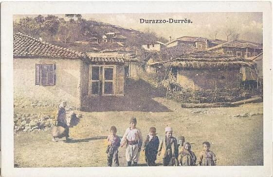
They were used as a primary location for graveyards in antiquity. Ten hills make up its range, six of which are significant: the Zogu Palace hill, the Pasha hill, Dautaj, Mount Durres, Porto Romano, and Bisht Palla. Due to the clay content of these hills, an unidentified writer once advised the residents of Dyrrachium not to build dwellings there.
Later, on the contrary, individuals constructed homes without standards in a range of hills. The Durres Hills’ range is currently under risk of erosion, and government funding is insufficient to prevent it. The concise history of the six major hills will be discussed in this article.
Moisiu Hill (King Zog’s Villa in Durres Hill)
It is among the most significant hills. It has an elevation of 98 meters. The hill used to be greener and have a park called “Youth Park” when Albania was still a socialist country. Due to the building on this significant hill in the 1990s, it was demolished. This hill is home to a number of monuments, such as King Zog’s Villa, lighthouse, Anjou Tower, and Saint George Church.
King Zog’s Villa is among the most significant sites that attracts daily visitors. Many notable people have lived here, including the president of Poland, Kwasniewski (1995-2005), the American consul general in Albania, Bernstein (1930–1933) and Soviet leader Khrushchev (1953-1964).
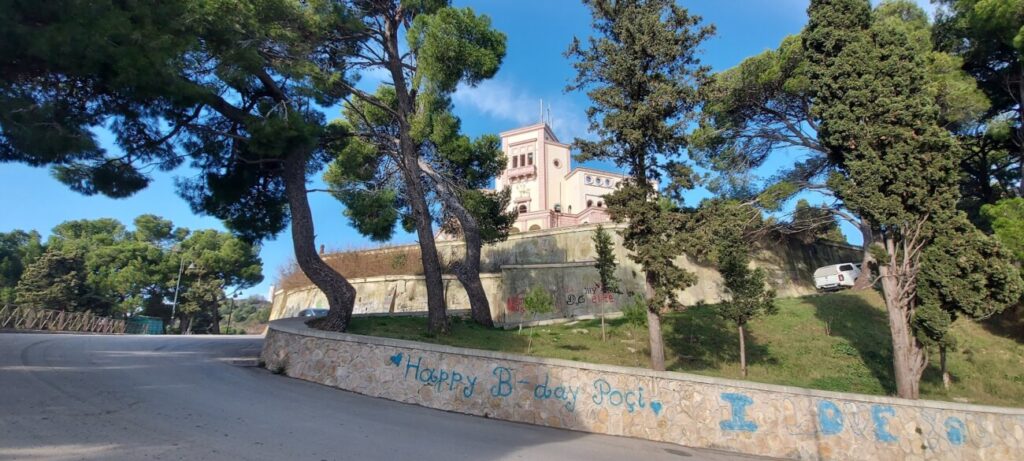
The villa was ransacked and abandoned during and after 1997. It can no longer be accessed, and the Albanian government now owns it. The Durres Lighthouse is situated nearby. It was constructed in 1926 by Italian architects, at the same time as King Zog’s Villa. The structure was completed in 1957. The tower has an octagonal shape and a 14-meter attitude. It is not a destination anymore.
The Anjou Tower is a further significant attraction. The Durres Balcony or Durres Cage is how the Durres population refers to it. It was built in Albania during the Anjou era, sometime in the 1270s. People take in the city and port views from there. A route that led to Durres Amphitheatre before the tower was built was shut in the 2000s.
The hill of Pasha (Stan)
Another significant hill in Durres is this one. It is situated halfway between the Durres Court and “Hajdar Dushi” school. Its name is connected to the narrative of Daumet and Heuzey’s findings in 1886. Previously, according to French archaeologists, the tower of Theodore Komnenos Dukas (1215–1230), the despot of Epirus, was located there.
The tower was later looted during the Turkish era and rebuilt as another tower until 1886. Because the Pasha of Durres lived nearby, it was thought that the tower had been dubbed “The tower of Pasha.” H. Daumet and Leon Heuzey travelled to Durres in 1886. They give the order to demolish the tower and to begin the excavations to discover the ruins of Medieval tower.
In the later years of the communist era, it contained a bunker. Its entrance was said to be close to “Hajdar Dushi,” an elementary school. It was constructed in the 1970s and used in emergency situations. Additionally, it was rumored that a tunnel once connected the hill to King Zog’s Villa. Finally, the hill was given the new name “Stan”, since it was thought that there was an animal stand there.
Dautaj Hill
It is located near Currila’s hills and the World War II Martyrs Museum. 70 meters above sea level is its lofty attitude. Here, some archeological finds from 1973 were made in the ruins of necropolis. A few stones dating to the IV–III century BC were discovered. The first indications of Iliro-Albanian civilization were these stones. For the names that we use in Albania, such as Teuta, Genti, Ardian, Aba, Epikados, Zaimina, etc., they offered evidence in Albanian history.
The Dautaj hill was terraced during Albania’s socialist era in order to stem the erosion. To stop the erosion, it was terraced during Albania’s socialist era. Clay was used to build its construction, and collisions were feared. In the 2000s, some homes were built in the region, which was inhabited. It cannot be reached yet.
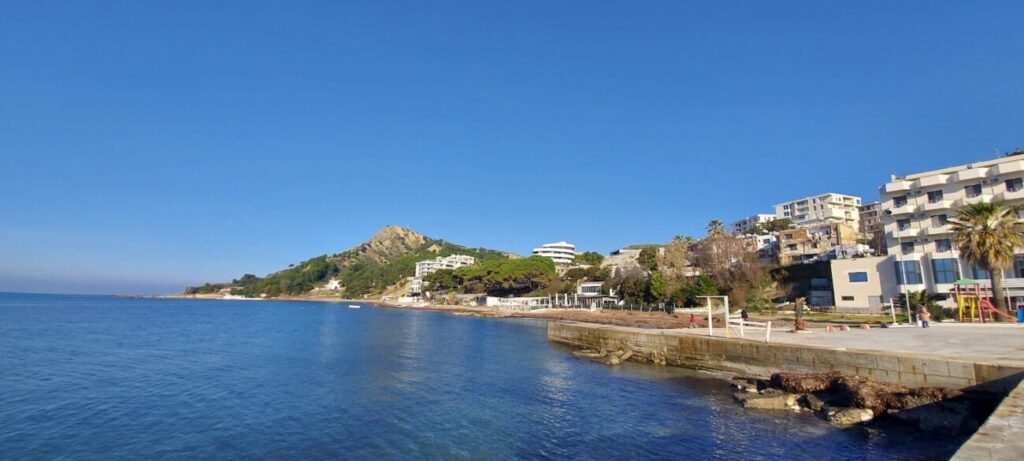
Kallmi Hills (The Hills of Durres Antennae or Mount Durres)
Between the hospital and Kallmi Beach, are located the Mount Durres and Currila-Kallmi range hills. They were designated as “Collines de Glaise” on a map by Daumet and Heuzey in the 1860s (in English “Clay Hills”). In the area of Antennae’s, which is now a military base, is one of Durres’ highest points. The range of Currila is situated south of these hills. Its name is the subject of a myth. Its meaning is “flowing water.” It was thought that there used to be a waterfall in that area that ended in the sea.
There are still olive trees in the Durres mountain range that were established during the Ottoman era. The area where the olive trees are located is thought to have served as an Ottoman camp during their siege of Kruja in 1450, according to Marin Barleti. In the future, the Albanian authorities are planning to open a road to connect Spitalla with the beaches of Kallmi and Currila.
Mount Durres (The Antennae Hill) 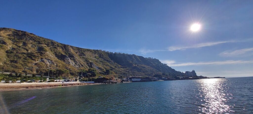
The Currila hill range (considered differently as Batllat zone)
Porto Romano Hills
They are close to the second port of Durres and situated in the northernmost section of the Durres hill range. The third round of Durres Castle’s walls are present. The Vth century saw their construction. Since Durres’ second port is still being built, the majority of the barriers do not exist today. Ancient fortifications, Porto Romano’s former concentration camp, and hill erosion are all in threat due to Durres’ second port’s building.
The hills in the cape of Pali (Bisht Palla)
They are situated to the north of Durres’ second harbor (Porto Romano). Its name has a connection to Saint Paul. He was a Roman-Jewish Messianic author. Paul is credited with writing the thirteen biblical books generally referred to as the Pauline epistles. Christians and churches are the recipients of the mailings. He wrote them to comfort, enlighten, and help people live Christian lives.
The spread of Christianity in Illyria is thought to have begun around 50–60 AD when he built a church on this beach. A Roman military outpost and strategic location that shielded Durres from the north was thought to exist at the Cape of Pali (also known as Portez).
The area was converted into a military base during Albania’s socialist era, and some of it still exists. According to Enver Hoxha, the name has a different etymology. He claimed that because the cape resembles a sword, the name Pali derives from the word “sword.” He thought Skanderbeg fought the Turks with a sword about 500 years ago. Hoxha defined the location as Cape Pali after this false narrative (Bishti I Palles in Albanian).
Conclusion
In conclusion, neither the populace nor the Albanian government kept the highlands safe. Previously, a park that no longer exists was located in Zogu’s Palace hill. Additionally, a few old sites (such as the archaeological dig site near Saint George Church, a section of the Durres Castle walls, and the necropolis ruins) contained the seeds of Albanian history. Durres won’t be one of Albania’s most picturesque cities if the government there doesn’t step in to safeguard the hills.